Hiking the Eiger Trail Beneath the North Face
Oh, the Eiger! Just saying the name probably sends a little shiver down your spine, doesn't it? For so many of us expats, the sheer majesty of the Swiss Alps is a huge draw, but then you hear about the North Face of the Eiger, and it conjures up images of daring, impossible climbs and a history that's both thrilling and terrifying. You might think, "Well, that's for the pros," and immediately dismiss the idea of getting anywhere near such an iconic peak. But what if I told you there's an incredible hiking trail that puts you right at the foot of this legendary mountain, offering breathtaking views and a deep connection to its history, all without needing ropes or ice axes? This guide is going to walk you through everything you need to know about hiking the Eiger Trail, making sure you experience this Swiss marvel safely and spectacularly.
Why the Eiger Trail is a Must-Do (Even If You're Not a Mountaineer)
When you first arrive in Switzerland, the mountains are often the first thing that captures your heart. But the Eiger isn't just any mountain; it's a global icon, largely thanks to its formidable North Face. Standing directly beneath it, you feel a connection to something truly monumental, and it’s an experience I truly believe every expat should have at least once.
The Allure of the North Face: History and Perspective
The Eiger's North Face, or "Eiger-Nordwand" as it's known here, has captivated climbers and onlookers for nearly a century. It's notorious for its extreme difficulty, changeable weather, and the tragic stories of those who attempted to conquer it. This isn't just a rock face; it's a piece of living history, a symbol of human ambition, resilience, and sometimes, folly.
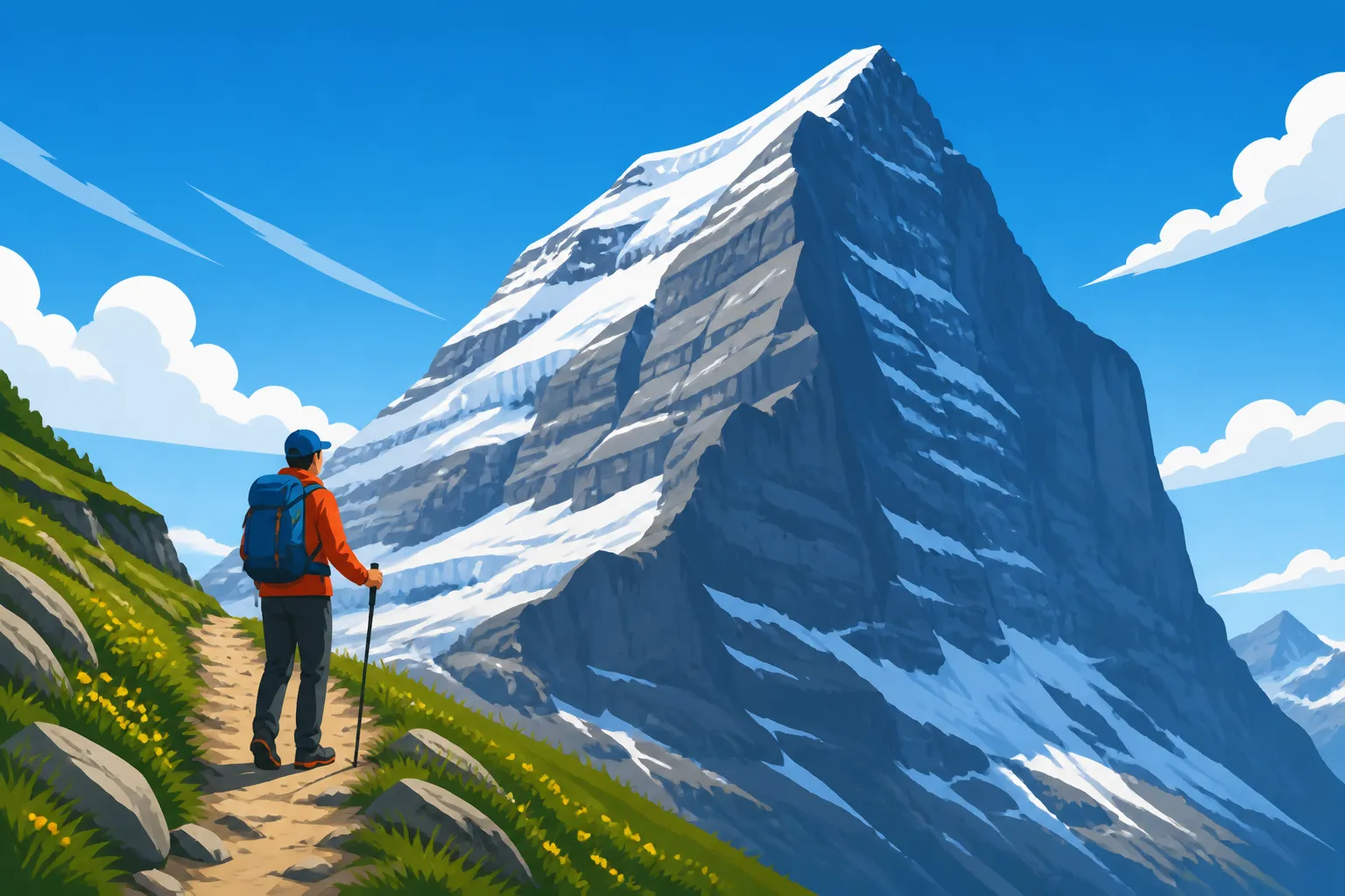
As you hike the Eiger Trail, you're not just walking; you're tracing paths directly beneath these legendary climbs. You'll see the scale of the face up close, gain an incredible appreciation for the tiny dots of climbers who dare to ascend it, and feel the raw, untamed power of nature. There are plaques along the trail, often with binoculars provided, that point out key features of the North Face like the "White Spider" or the "Death Bivouac," giving you a profound sense of the challenges faced by those legendary alpinists. It's a completely different experience than just seeing the mountain from afar; it's an immersive historical journey as much as a physical one. You'll probably find yourself pausing, just staring up, and imagining the incredible feats (and heartbreaks) that have unfolded on that very rock.
Accessibility and Views: A Different Angle on Grindelwald
One of the best things about the Eiger Trail is its surprising accessibility. You don't need to be a seasoned mountaineer to enjoy it. This isn't a scramble or a technical climb; it's a well-maintained, albeit sometimes steep, hiking path. What truly sets it apart, though, are the panoramic views it offers, not just of the Eiger itself, but of the surrounding Grindelwald valley and the other majestic peaks of the Jungfrau Region.
Imagine walking a path that unfolds right at the base of a 1,800-meter vertical wall of rock and ice, while simultaneously looking out over lush green alpine meadows, charming Swiss chalets in the distance, and peaks like the Wetterhorn and the Fiescherhorn. The contrast is striking – the imposing, dark rock of the Eiger above you, and the vibrant, lively landscape stretching out below. As you move along the trail, the perspective shifts constantly, offering new angles and photo opportunities at every turn. You get to see the famous village of Grindelwald from a unique high-alpine vantage point, understanding why this area is so beloved by locals and tourists alike. It’s an easy way to experience The Swiss Alps for Expats: Hiking, Skiing, and Mountain Access without needing to commit to days of trekking.
Planning Your Eiger Trail Adventure: Logistics and Preparation
Like any good Swiss adventure, a successful hike on the Eiger Trail starts with solid planning. Don't just show up hoping for the best; a little preparation goes a long way, especially when you're dealing with alpine conditions.
Getting There: Trains, Cable Cars, and Starting Points
The Eiger Trail is wonderfully integrated into Switzerland's fantastic public transport network, making it incredibly easy to reach even if you don't own a car. Your journey will typically start by heading to Grindelwald. From major hubs like Bern or Zurich, you'll take an SBB train to Interlaken Ost, then switch to a regional train for the scenic ride up to Grindelwald Terminal. From there, you'll embark on one of Switzerland's impressive feats of engineering: the Eiger Express tricable gondola.
This modern cable car whisks you directly from Grindelwald Terminal to the Eigergletscher station, which is your starting point for the Eiger Trail. The ride itself is an experience, offering stunning views as you ascend. If you have a SBB Travelcards: Is the Generalabonnement (GA) Worth the CHF 4000+ Cost? or a The Half-Fare Travelcard (Halbtax): The Must-Have Pass for Swiss Residents, you'll benefit from significant discounts on these journeys, making the costs more manageable. Remember, train tickets can be booked via SBB or platforms like Omio, which can sometimes show comparative routes. Ensure you purchase your cable car ticket to Eigergletscher in advance or at the terminal. This approach is much less stressful than driving and trying to find parking, which is often limited and expensive in these popular mountain areas.
Key Transport Steps:
- Train to Interlaken Ost: From most major Swiss cities.
- Train to Grindelwald Terminal: Change at Interlaken Ost.
- Eiger Express Gondola to Eigergletscher: The trailhead starts right from the station.
What to Pack: Essential Gear for a High-Alpine Day Hike
Don't underestimate the mountains, even on a well-maintained trail. The weather can change in an instant up here, and being prepared is key to enjoying your hike. You’ll be at high altitude, exposed to the elements, so layers are your best friend.
Here's a breakdown of what should definitely be in your daypack:
- Proper Footwear: Sturdy hiking boots are non-negotiable. The trail, while not overly technical, has loose scree in places and can be uneven. Good ankle support and grip are vital. Leave the sneakers at home for this one!
- Layers of Clothing: Even on a sunny summer day, it can get chilly at 2,320 meters (Eigergletscher altitude), especially if a cloud rolls in or the wind picks up. Pack a base layer, a mid-layer (fleece or light jacket), and a waterproof/windproof outer shell. You'll likely shed and add layers throughout the hike.
- Sun Protection: The sun at altitude is incredibly strong. Sunglasses, a hat, and high-SPF sunscreen are absolute musts. Trust me, I've seen more than one expat (and been one myself!) turn lobster-red after a day in the mountains.
- Water and Snacks: This is a 2-3 hour hike, so bring at least 1-1.5 liters of water per person. High-energy snacks like nuts, dried fruit, chocolate, or a sandwich will keep your energy levels up. While there’s a restaurant at the start/end, you want to be self-sufficient on the trail.
- First-Aid Kit: Blister plasters, pain relievers, antiseptic wipes – the usual suspects. A small kit can make a big difference for minor mishaps.
- Map and Navigation: While the trail is well-marked, having an offline map on your phone (like from SwitzerlandMobility or Komoot) or a physical map is always a good idea, just in case.
- Camera: You'll want to capture these views! A phone camera is fine, but if you have a proper camera, bring it along.
- Hiking Poles (Optional but Recommended): They help with stability, especially on descents and uneven terrain, taking pressure off your knees.
For a more general overview, check out our guide on What to Pack for a Day Trip to the Swiss Alps.
Best Time to Hike: Seasons, Weather, and Trail Conditions
The Eiger Trail is typically open from late June/early July through October, depending on snow conditions. Outside of these months, parts of the trail might be covered in snow or ice, making it dangerous or impassable.
- Summer (July-August): This is the most popular time, with generally stable weather and the trail completely clear of snow. Expect warmer temperatures, but also more crowds. Book your transport and potentially any accommodation in Grindelwald (if staying overnight) well in advance, especially through platforms like Booking.com.
- Autumn (September-October): Many experienced hikers prefer autumn. The crowds thin out, the air is crisp, and if you hit it right, the golden larch trees against the white peaks create truly spectacular scenery. However, daylight hours are shorter, and the weather can become more unpredictable with early snowfalls possible. Always check the forecast and webcam images on the morning of your hike.
Before you head out, always check the current trail status and weather conditions. Websites for the Jungfrau Region, local tourism offices, and dedicated Weather Apps and Webcams for Planning Swiss Mountain Trips are invaluable resources. A sunny forecast in the valley doesn't always mean sunshine at 2,300 meters! Be prepared to change your plans if the weather looks iffy; the mountains demand respect.
On the Trail: What to Expect and How to Navigate
Alright, gear packed, tickets bought, weather checked – you're finally at Eigergletscher. Now, for the real adventure! The Eiger Trail isn't just a walk; it's an immersive experience that puts you face-to-face with one of the most famous mountains in the world.
The Route Itself: Eigergletscher to Alpiglen
The Eiger Trail is a roughly 6-kilometer (3.7 miles) hike, primarily downhill, from the Eigergletscher station (2,320 m / 7,610 ft) to the charming hamlet of Alpiglen (1,616 m / 5,300 ft). The net elevation descent is over 700 meters, which sounds like a lot, but it’s spread out enough that it feels manageable for most reasonably fit hikers. It usually takes between 2 to 3 hours to complete, depending on your pace and how many times you stop to gawk (and you will stop to gawk).
The trail officially begins right outside the Eigergletscher station. Look for the yellow hiking signs pointing towards "Eiger Trail" or "Alpiglen." The path is clearly marked with the standard white-red-white Swiss hiking markers.
From the moment you start, the North Face looms above you, an ever-present, awe-inspiring companion. You'll traverse rocky terrain, pass through lush alpine meadows, and even walk directly under the infamous Eigerwand (Eiger Wall) and Kleine Scheidegg train tunnels, where tiny windows (some of which were historically used by climbers) offer fleeting glimpses out to the dramatic landscape. Information boards along the way provide fascinating details about the Eiger's climbing history, geology, and local flora and fauna, enriching your journey.
While mostly downhill, there are some sections that are steeper or have loose scree, so watch your footing. The path also winds and turns, often with stunning drop-offs to your right (if you're heading towards Alpiglen). This isn't a hike for those with a severe fear of heights, but for most, the well-maintained path and safety chains in truly exposed areas provide reassurance. It's a fantastic example of a Swiss Hiking for Beginners: Trail Grades and the SAC System route that offers big views without extreme technical difficulty.
Safety First: Understanding Alpine Hazards and Etiquette
Even on a popular trail like the Eiger Trail, respecting the alpine environment and practicing common sense is crucial. The Swiss are generally very pragmatic about safety, and you should be too.
- Falling Rocks: The Eiger is an active mountain, and rockfall can occur, especially after heavy rain or during thaws. While less common on the trail itself, always be aware of your surroundings, especially in gullies or near rock faces. The trail is designed to avoid the most dangerous areas, but it's not foolproof.
- Weather Changes: As mentioned, mountain weather is notoriously fickle. A clear morning can turn into a stormy afternoon with rain, hail, or even snow, especially later in the season. Carry your waterproofs, and if a storm rolls in, seek shelter immediately or turn back if it's safe to do so. In an emergency, know the Emergency Medical Services: Ambulances, REGA, and Crisis Protocols and call 144.
- Trail Etiquette: This is a shared path. Uphill hikers generally have the right of way. Greet fellow hikers with a friendly "Grüezi" (Swiss German), "Bonjour" (French), or "Ciao" (Italian). Keep noise levels down to enjoy the tranquility and respect others. Pack out everything you pack in – leave no trace.
- Stay on the Path: Don't stray from the marked trail. Not only can this be dangerous (unstable ground, hidden drops), but it can also damage fragile alpine vegetation.
Always remember the principle of Mountain Safety in Switzerland: Weather, Gear, and Emergency Numbers. Preparation and awareness are your best defenses against potential dangers.
Capturing the Views: Photography Tips
You'll be surrounded by some of the most dramatic scenery in Switzerland, so naturally, you'll want to capture it! The interplay of light and shadow on the Eiger North Face changes throughout the day, offering unique opportunities.
- Morning Light: If you start early, the morning light illuminates the North Face beautifully, casting long shadows and highlighting its textures. The air is often clearer then, too.
- Wide-Angle Shots: To truly capture the grandeur of the Eiger and the surrounding valley, a wide-angle lens (or your phone's wide-angle setting) is invaluable.
- Perspective: Don't just shoot the mountain itself. Try to incorporate elements of the trail, other hikers, or alpine flowers in the foreground to give a sense of scale and depth. The train tunnels are also great for framing shots.
- Video: A short video panning across the North Face or the valley can often convey the immense scale better than a still photo.
- Take Your Time: This isn't a race. Stop frequently, soak it all in, and find those perfect spots for your photos. Some of the best shots come from just patiently waiting for the right moment or the right angle.
Post-Hike Relaxation and Nearby Gems
After descending from the shadow of the Eiger, you'll feel a sense of accomplishment and a unique connection to this legendary mountain. The adventure isn't over yet, though!
Refueling in Alpiglen or Grindelwald
Your Eiger Trail hike officially ends at Alpiglen. This small, picturesque hamlet is home to the delightful Berghaus Alpiglen, a traditional mountain restaurant right by the train station. This is the perfect spot to treat yourself to a well-deserved meal and a refreshing drink. Their menu features classic Swiss mountain fare, like hearty rösti, cheese platters, or a warm soup. Sitting on their terrace, gazing back up at the Eiger (which looks even more impressive after you've walked beneath it!), is an incredibly satisfying way to conclude your hike.
From Alpiglen, you can catch a regional train back down to Grindelwald Terminal, or even all the way to Interlaken Ost if that's your next destination. If you decide to spend more time in the area, Grindelwald village itself offers numerous restaurants, cafes, and shops where you can find everything from fine dining to casual snacks. Don't forget to check out some of the local delicacies after your demanding trek! For more dining ideas in the region, you can also look into Mountain Restaurants (Bergrestaurants): Dining With a View.
Exploring Beyond the Eiger Trail
The Jungfrau Region is an absolute playground, and the Eiger Trail is just one of its many highlights. If you have more time or are looking for additional adventures, there’s plenty to explore.
- Jungfraujoch – Top of Europe: From Eigergletscher, you could have continued on the train up to the Jungfraujoch 'Top of Europe': Planning the Trip and Saving Money, Europe's highest railway station, for panoramic views, ice palaces, and snow activities. It's a completely different (and much colder!) experience.
- First – Cliff Walk & Adventure Activities: Head to Grindelwald First for a thrilling cliff walk, a zip line, mountain carts, and scooters. It's a fun-filled day out with stunning vistas. Many expat families love this area for its diverse offerings. You can often book combined tickets for transport and activities via platforms like GetYourGuide for convenience.
- Kleine Scheidegg: This mountain pass, located between the Eiger and the Lauberhorn, offers incredible views of the Eiger North Face from a different angle, as well as the Eiger Glacier. It's accessible by train and is a great starting point for other, easier walks.
- Interlaken: If you're based in Interlaken, you've got easy access to both lakes Thun and Brienz, plus adventure sports like paragliding and canyoning. It makes for an excellent base, as highlighted in our Exploring Interlaken: Gateway to the Jungfrau Region guide. It's also a common stop on many Day Trips from Bern: Thun, Interlaken, and the Emmental plans.
Taking the time to discover more of this region after your Eiger Trail hike will give you an even richer experience of the Bernese Oberland's natural beauty and incredible engineering.
Eiger Trail at a Glance
Here’s a quick summary of the key facts for planning your hike:
| Feature | Details |
|---|---|
| Start Point | Eigergletscher station (accessible by Eiger Express gondola from Grindelwald) |
| End Point | Alpiglen train station |
| Distance | Approx. 6 km (3.7 miles) |
| Duration | 2 – 3 hours (one-way) |
| Elevation Change | Approx. 700m descent |
| Difficulty | Moderate (T2 – Mountain Hiking on Swiss scale) |
| Best Season | Late June/Early July to October (check conditions) |
| Highlights | Up-close views of Eiger North Face, information panels, Berghaus Alpiglen |
So, there you have it. The Eiger Trail isn't just a challenging name; it's a truly spectacular and surprisingly accessible way to connect with the raw power and rich history of the Swiss Alps. Go forth, explore, and let that majestic North Face leave an indelible mark on your Swiss adventure!
Disclaimer
Please note that while I strive to provide accurate and up-to-date information, conditions in the Swiss Alps can change rapidly. Always double-check current weather forecasts, trail conditions, and public transport schedules before embarking on any hike. Personal safety is your responsibility; ensure you have appropriate gear and fitness for the chosen activity. This guide is for informational purposes only and does not constitute professional advice.