Swiss Hiking for Beginners: Trail Grades and the SAC System
When you first arrive in Switzerland, the sheer beauty of the mountains is breathtaking, but the thought of hiking them can feel utterly intimidating. You see locals effortlessly striding up paths while you're still trying to decipher what a "2.5-room apartment" means. It's easy to feel overwhelmed by the vast network of trails, the cryptic signage, and the vague warnings about "sure-footedness." Trust me, we’ve all been there, standing at a trailhead, scratching our heads. This guide is going to strip away the confusion, explaining Swiss hiking trail grades and the renowned SAC system so you can confidently hit those stunning paths.
Demystifying Swiss Hiking Trail Grades: More Than Just a Color
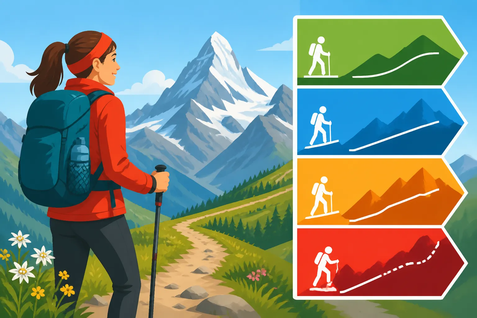
Navigating the Swiss hiking network can feel like learning a new language, especially when you encounter the different colored signs. These colors aren't just for aesthetics; they are a vital, easy-to-understand visual cue that tells you a lot about the difficulty and demands of a particular trail. Understanding them is your first step to safe and enjoyable trekking in this magnificent country. Forget the complexities of the T-scale for a moment – the colors are what you'll see first, and they are your immediate indicator of what lies ahead.
The Yellow Trails: Easy Walks for Everyone
When you see a yellow diamond sign, often with a little green hiker silhouette, you've found yourself on a designated "Wanderweg" or walking path. These are the gentle giants of the Swiss hiking world, designed for broad accessibility. They are typically well-maintained, clearly marked, and generally pose no technical challenges. Think of them as your friendly introduction to Swiss nature, perfect for a leisurely afternoon stroll or a family outing with the kids.
These yellow trails are where you build your confidence and truly soak in the Swiss scenery without breaking a serious sweat. They often follow paved or gravel paths, winding through charming villages, alongside picturesque lakes, or through verdant forests with minimal elevation gain. You might even find yourself on one while exploring a town like Lucerne, leading you along the lake promenade or up a gentle incline to a panoramic viewpoint. For many expats, these are the ideal starting point, allowing you to enjoy the fresh air and stunning views without needing specialized gear or an elite fitness level. You can wear sturdy sneakers or light hiking shoes, and you'll be perfectly fine. This is also where you can truly appreciate the joy of a casual walk, perhaps stopping at a restaurant along the way for a refreshing drink or a traditional Swiss meal. You don't need to be an experienced trekker to enjoy the beauty here; just a willingness to explore. If you're looking for ideas, there are plenty of Best Easy Day Hikes Near Zurich and Geneva that fall into this category.
The White-Red-White Trails: Mountain Hiking for the Adventurous Beginner
Now, when those familiar yellow signs start to feature a white-red-white stripe, you've stepped up to a "Bergwanderweg," or mountain hiking trail. This is where things get a bit more serious, but still well within the reach of a prepared beginner looking for a bit of a challenge. These trails venture higher into the alpine terrain, often involving steeper ascents and descents, uneven ground with roots and rocks, and sometimes sections that require a degree of sure-footedness. You won't typically encounter exposed ledges requiring a head for heights, but you'll definitely feel like you're in the mountains.
On white-red-white trails, proper hiking boots with ankle support are no longer optional – they're essential. These trails demand more physical exertion and a good sense of balance. The paths can be narrow in places, and while well-marked, they might not be as manicured as their yellow counterparts. You might find yourself scrambling over small rock sections or navigating through scree fields. It's crucial to pay attention to the Reading Swiss Trail Signs: Yellow, White-Red-White, and Blue Markers as the time estimates will accurately reflect the increased difficulty. These trails offer immensely rewarding views and a true sense of accomplishment, moving you beyond the gentle strolls into the heart of the Alpine experience. They are perfect for those who have a moderate level of fitness and are eager to explore more rugged landscapes, perhaps embarking on a challenging half-day hike that culminates in a spectacular mountain vista before taking a Mountain Railways and Cable Cars: Reaching Switzerland's Peaks ride back down.
The White-Blue-White Trails: Alpine Hiking for the Experienced Only
This is where the warnings become non-negotiable. The white-blue-white striped signs denote an "Alpinwanderweg" or alpine hiking trail. These are serious, demanding routes that are strictly reserved for experienced, well-equipped, and extremely fit hikers. This isn't just a harder hike; it's often a different beast altogether, crossing into true alpine environments where the terrain is treacherous, exposed, and requires specific skills and gear.
Alpine hiking trails can involve glacier crossings, climbing sections with fixed ropes or chains (via ferrata elements), steep scree slopes, and significant exposure to heights. The weather in these high-alpine regions can change dramatically and rapidly, turning a sunny morning into a whiteout blizzard in hours. It's not uncommon to encounter snow and ice even in summer. For these trails, you need specialized equipment like crampons, an ice axe, a helmet, and often a rope, not to mention proficiency in using them. Navigation requires expert map-reading skills and the ability to interpret the terrain without constant markers. If you're new to Switzerland or new to serious alpine conditions, these trails are emphatically not for you. While the allure of untouched peaks is strong, venturing onto a white-blue-white trail unprepared is dangerous and can quickly become life-threatening. Always respect these warnings and know your limits – the mountains will always be there for when you've built the necessary experience.
The SAC System: Your Guiding Hand in the Alps
Beyond the color-coded signs, the Swiss Alpine Club (SAC) plays an instrumental role in shaping the hiking experience in Switzerland. The SAC's system, particularly its T-scale (T1-T6), provides a more granular and technical classification of trails. While you primarily see the color-coded signs on the trails themselves, understanding the SAC system gives you a deeper insight into the demands of a route and helps you plan accordingly. It's the technical backbone to the visual color cues.
What is the Swiss Alpine Club SAC?
The Swiss Alpine Club (SAC), or Schweizer Alpen-Club, is one of the oldest and largest alpine clubs in Switzerland, founded in 1863. It's a non-profit organization dedicated to promoting mountaineering, hiking, and the protection of the alpine environment. Think of them as the custodians of the Swiss Alps, maintaining trails, educating the public on mountain safety, and operating a vast network of mountain huts. They are the reason you can trust the consistency and quality of the trail markings and classifications you encounter.
Being a member of the SAC comes with several benefits, including discounted stays at their mountain huts, access to training courses in various alpine disciplines, and a subscription to their magazine, which is packed with route suggestions and alpine news. Beyond membership perks, the SAC’s primary contribution to every hiker, member or not, is its rigorous trail grading system and its commitment to safety. They are heavily involved in the maintenance and marking of the entire Swiss hiking network, ensuring that the yellow, white-red-white, and white-blue-white signs are clear, accurate, and regularly inspected. When you're out there, trusting that the sign you're following accurately reflects the terrain ahead, you have the SAC to thank. Their expertise ensures that even for beginners, the information provided is reliable, giving you peace of mind to focus on the stunning scenery.
How SAC Huts Enhance Your Hiking Experience
One of the most unique and cherished aspects of the Swiss hiking experience, largely managed by the SAC, is the network of mountain huts (SAC Hütten). These aren't fancy hotels; they are rustic, essential refuges strategically placed high in the mountains, often at the end of a long day's hike or as a base for multi-day treks. They provide basic accommodation, often in dormitories, along with simple but hearty meals and drinks. For many, a stay in an SAC hut is the quintessential Swiss alpine experience.
SAC huts are indispensable for anyone venturing on longer or more challenging Swiss Hiking for Beginners: Trail Grades and the SAC System. They offer a safe haven from sudden weather changes, a place to rest tired legs, and a chance to meet fellow hikers from around the world. Imagine reaching a remote hut after hours of trekking, peeling off your boots, and sharing a warm meal and stories with others, all while surrounded by breathtaking panoramic views. It’s an incredible way to immerse yourself in the mountains. You generally need to book your spot in advance, especially during peak season (summer), as they fill up quickly. While you can often pay cash, many huts now accept card payments. If a hut is part of a longer tour, you might even find some guided trips on platforms like GetYourGuide that include these overnight stays, taking the hassle out of planning. If you're embarking on a multi-day journey and looking for accommodation in the valleys before or after your alpine adventures, platforms like Booking.com can be invaluable for securing a comfortable bed in a nearby town.
Essential Gear and Preparation for Your First Swiss Hike
So, you've decided to tackle a beautiful white-red-white trail, or maybe even just a longer yellow path. That's fantastic! But before you head out, remember that the Swiss mountains, even on seemingly easy trails, demand respect. Proper preparation and the right gear aren't just for serious mountaineers; they're for everyone who wants to enjoy their hike safely and comfortably. Cutting corners here can quickly turn a memorable experience into a miserable one.
Footwear and Clothing: Don't Underestimate the Mountains
Let's talk boots first. Please, for the love of all that is holy, do not wear your city sneakers on anything beyond a flat, paved yellow path. For any white-red-white trail, sturdy hiking boots with good ankle support are an absolute must. They protect you from twists and sprains on uneven terrain, offer better grip on slippery surfaces, and keep your feet dry if you encounter unexpected puddles or light rain. Your feet are your most important asset on a hike, so invest in them.
Next, clothing. The "onion principle" (layering) is your best friend in the Swiss Alps. Weather can change dramatically from valley to peak, and even within a few hours. You might start in cool shade, hike into direct sun, and then get hit by a sudden gust of wind or a rain shower. Pack layers you can easily add or remove: a wicking base layer, an insulating mid-layer (fleece or light puffy jacket), and a waterproof/windproof outer shell. Even on a sunny day, a light rain jacket is a non-negotiable item in your backpack. Don't forget sun protection – a hat, sunglasses, and high-SPF sunscreen are vital, as the sun at altitude is incredibly strong. Trust me, I once saw a tourist in flip-flops and a tank top try to hike to a mountain lake. It didn't end well for their feet or their sunburn. When thinking about What to Pack for a Day Trip to the Swiss Alps, these items should always be at the top of your list.
Navigation and Safety: Tools and Mindset
Even on well-marked Swiss trails, knowing how to navigate and being prepared for the unexpected is crucial. While the yellow diamond signs are everywhere, a reliable map is your backup. The SwitzerlandMobility website and app are absolutely brilliant for this, offering detailed maps with trail overlays, elevation profiles, and estimated walking times. Having it downloaded offline on your phone (and a fully charged power bank!) is a smart move. Many seasoned hikers also carry a physical map, just in case their phone dies or gets wet.
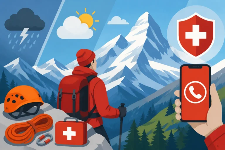
Beyond maps, carry enough water and snacks, even for shorter hikes. Dehydration and low blood sugar can quickly sap your energy and judgment. A small first-aid kit with blister plasters, pain relievers, and any personal medications is also essential. Most importantly, cultivate a safe mindset: tell someone where you're going and when you expect to be back. Don't take unnecessary risks for a photo. If the weather turns, or you feel unwell, turn back. The mountains will always be there another day. Remember the emergency number 144 for alpine rescue, and 112 for general emergencies. For more detailed insights into staying safe, check out Mountain Safety in Switzerland: Weather, Gear, and Emergency Numbers.
Planning Your Route: Apps, Maps, and Local Wisdom
The beauty of hiking in Switzerland is the incredible infrastructure that supports it. You don't have to be an expert cartographer to plan a fantastic route, but leveraging the available resources will make your planning much easier and your hike much more enjoyable. It's about combining digital convenience with local knowledge to ensure you’re prepared for whatever the trail might throw at you.
Utilizing SwitzerlandMobility and Local Tourist Offices
SwitzerlandMobility (SchweizMobil) is quite simply the bible for outdoor enthusiasts in Switzerland. It's an official platform that details the entire network of hiking, cycling, mountain biking, skating, and canoeing routes across the country. Their website and mobile app are incredibly user-friendly and offer a wealth of information. You can filter by activity, difficulty, and region, view detailed topographic maps, see elevation profiles, and get accurate time estimates for each segment of a trail. It even shows public transport stops, which is invaluable since many amazing trailheads are easily accessible by bus or train. You can explore various routes, from the gentle lakeside paths to challenging mountain ascents, all with the click of a button. For instance, if you're planning a trip, you can easily find trails close to your destination and integrate your travel plans using services like Omio to book your train tickets to the trailhead.
Beyond digital tools, never underestimate the power of local tourist offices. Whether you're in Zermatt, Grindelwald, or a smaller village, these offices are staffed by locals who know the current conditions intimately. They can provide up-to-the-minute information on trail closures (due to snow, rockfall, or maintenance), offer recommendations based on your fitness level and interests, and often provide free local maps. A quick chat can save you from a wasted trip or an unexpectedly difficult route. They are also excellent sources for discovering Family Travel in Switzerland: Kid-Friendly Destinations and Tips if you're hiking with little ones.
Reading the Landscape and Understanding Signage
Once you're on the trail, the clear and consistent signage is one of Switzerland's greatest assets for hikers. You'll primarily follow the ubiquitous yellow diamond signs, often pointing the way with black text indicating your destination and the estimated walking time. On mountain trails, these estimates are based on an average hiker's pace and assume you're walking uphill at about 400 meters per hour and downhill at 800 meters per hour. Pay attention to these times – they are usually quite accurate and include short breaks.
When you see the white-red-white or white-blue-white markings, you'll notice the signs might be smaller, painted directly on rocks or trees, and more frequent. This is because these trails require constant confirmation of the route to ensure safety. It’s not just about getting to a destination; it's about staying on the correct, safe path. Learn to read the topography on your map, correlating it with the actual landscape. Look for prominent features like peaks, valleys, and rivers to orient yourself. Also, be mindful of weather conditions. If a clear blue sky suddenly gives way to ominous clouds, that's the landscape giving you a warning. Always carry an up-to-date forecast in your mental backpack, or better yet, on a reliable weather app. For a deeper dive into decoding what you see, refer to the guide on Reading Swiss Trail Signs: Yellow, White-Red-White, and Blue Markers.
Common Pitfalls and Expat Advice for New Hikers
As an expat, you might be used to hiking elsewhere, but the Swiss Alps have their own unique character and demands. It's easy to make assumptions, or simply underestimate the power and unpredictability of these majestic mountains. Many of us have learned these lessons the hard way, so let me share some common pitfalls to help you avoid them.
Overestimating Your Abilities: The Swiss Mountains Are No Joke
This is, by far, the most common mistake newcomers make. You might be fit from city living or used to trails back home, but the elevation gain, the uneven terrain, and the sheer scale of the Swiss Alps are often a different ball game. I once met a couple who attempted a white-red-white trail near Grindelwald in brand-new running shoes, expecting a gentle slope. They ended up calling for help after getting stuck on a steep, rocky descent, totally exhausted and with ruined footwear.
Start small. Seriously. Even if you're an experienced hiker elsewhere, begin with some yellow trails, then try a shorter, less demanding white-red-white route. Build up your confidence, get a feel for the unique Swiss trail conditions, and assess your own fitness in this environment. There’s no shame in turning back if a trail feels beyond your capabilities. The mountains aren't going anywhere, and you can always come back another day, better prepared. Don't let your ego lead you into a dangerous situation. It's far better to complete an "easy" hike feeling strong and invigorated than to struggle on a "moderate" one and risk injury.
Weather Whims and Unexpected Challenges
The Alpine weather is notoriously fickle. You can set out under a brilliant blue sky, feeling the warmth of the morning sun, only for dark clouds to roll in from behind a peak a couple of hours later, bringing driving rain, hail, or even snow, even in summer. I've had perfectly planned hikes near Interlaken turn into a battle against a sudden thunderstorm that came out of nowhere. The temperature can drop by 10-15 degrees Celsius in minutes.
This is why the layering system is non-negotiable, and why a waterproof shell is always in my backpack. Always check the mountain-specific weather forecast before you leave – not just the valley forecast. Be prepared to change your plans last minute if the forecast looks iffy, or if conditions visibly deteriorate. A sunny valley doesn't guarantee a sunny peak. Visibility can drop to zero in heavy fog, making navigation incredibly difficult, even on familiar trails. Always assume the worst possible weather and pack accordingly. It’s always better to carry an extra layer you don't use than to be caught shivering and soaked miles from shelter.
Respecting Nature and Local Rules
Switzerland is pristine for a reason: Swiss people take immense pride in their environment and adhere to strict rules, and expats are expected to do the same. This means "Leave No Trace" is not just a suggestion; it's a way of life. Carry out everything you carry in, including fruit peels and biodegradable waste. If you see a bin, use it; otherwise, carry it until you find one.
You'll often hike through pastures with grazing cows, sheep, or goats. These are usually docile, but keep a respectful distance, especially if there are calves. Dogs should be kept on a leash, particularly near farm animals. Always close gates behind you. And while it might seem tempting to cut across a field or create your own path, stick to the marked trails. This prevents erosion, protects delicate flora and fauna, and respects private land. Remember, you are a guest in this beautiful country, and part of the joy of Exploring Switzerland: The Complete Travel Guide for Residents (2027) is embracing its customs. Be mindful of quiet hours, especially early mornings or late evenings if you're passing through residential areas, and enjoy the peace and tranquility that the Swiss cherish.
Sample Beginner-Friendly Hikes to Get You Started
Now that you're armed with the knowledge of trail grades and essential safety tips, it's time to put it into practice. Starting with a few tried-and-true beginner-friendly hikes is the best way to build your confidence and fall in love with Swiss hiking. These suggestions span different regions and difficulty levels, offering a perfect blend of accessibility and stunning scenery.
Easy Yellow Trails for a Relaxed Introduction
For your absolute first forays, stick to the yellow-marked "Wanderwege." These paths are generally well-groomed, have minimal steep sections, and offer incredible scenic rewards without demanding much technical skill or strenuous effort. They are perfect for a family day out, a solo contemplative walk, or a casual outing with friends.
One fantastic option is the Lake Zurich Promenade Walk. You can pick up the path in various sections, for instance, from Thalwil to Richterswil. This mostly flat, paved, or gravel path hugs the shimmering shoreline, offering continuous views of Lake Zurich and the distant Alps. You’ll pass through charming villages like Horgen and Wädenswil, complete with lakeside restaurants and public swimming areas (Badis). It’s easy to hop on or off the train at almost any village, allowing you to tailor the length of your walk. This kind of walk is perfect for testing your The Half-Fare Travelcard (Halbtax): The Must-Have Pass for Swiss Residents usage and enjoying the scenery at your own pace. Another lovely choice, particularly if you're in the French-speaking part of Switzerland, is a section of the Lavaux Vineyard Terraces. While some parts are steeper, you can choose gentler segments, like the stretch between Lutry and Epesses. Here, you'll stroll through UNESCO World Heritage vineyards, with breathtaking views over Lake Geneva and the Savoy Alps. The paths are often paved or well-maintained gravel, and there are plenty of small wine cellars (caves) to stop for a tasting.
White-Red-White Trails for a Taste of the Alps
When you’re ready to step it up a notch and experience the quintessential Swiss mountain scenery, but still within a manageable range for a prepared beginner, seek out white-red-white "Bergwanderwege." These trails will challenge you with some ascents and descents, uneven terrain, and higher altitudes, but the views are absolutely worth it.
A classic and highly recommended white-red-white trail for beginners is the Bachalpsee Hike from First, above Grindelwald. You take a scenic gondola up to First, and from there, a beautifully maintained white-red-white path leads you to the stunning turquoise waters of Bachalpsee, framed by the majestic Eiger, Mönch, and Jungfrau peaks. The hike itself is relatively gentle, mostly uphill on the way out, but not overly steep, and takes about an hour each way. The path is wide enough in most places, and while rocky in spots, it doesn't require any technical climbing. It’s an incredibly rewarding experience, offering some of the most iconic Swiss views. For a full breakdown, check out The Bachalpsee Hike from First Above Grindelwald. Another excellent option is a segment of the Five Lakes Walk (5-Seenweg) in Zermatt. You can access it by taking the funicular from Zermatt up to Sunnegga, then various chairlifts or shorter hikes to get to different starting points. While the full Five Lakes Walk is longer, you can do a shorter loop, perhaps focusing on two or three lakes, which still falls into the white-red-white category. The views of the Matterhorn reflected in the clear mountain lakes are simply unforgettable. Just remember to wear proper hiking boots, pack layers, and carry enough water!
Swiss Hiking Trail Grade Overview
To quickly sum up what we've discussed, here's a table outlining the primary Swiss hiking trail grades. This should give you a quick reference when you're planning your next adventure.
| Trail Grade Color | SAC T-Scale | Description | Required Gear | Experience Level |
|---|---|---|---|---|
| Yellow | T1 | Flat to gently undulating terrain, well-maintained paths, no exposure. | Sturdy shoes/sneakers | Anyone, including families with strollers, casual walkers |
| White-Red-White | T2 – T3 | Mountain paths, some steep sections, uneven terrain, occasional exposure. | Hiking boots with ankle support | Moderate fitness, sure-footedness, some experience |
| White-Blue-White | T4 – T6 | Alpine routes, often unmarked or minimally marked, exposed, glaciers, rock sections. | Specialized mountaineering gear (crampons, axe, rope) | Experienced alpine trekkers, often with guides |
Disclaimer
The information provided in this guide is for general informational purposes only and does not constitute professional advice. While we strive to provide accurate and up-to-date information, hiking conditions in Switzerland can change rapidly due to weather, terrain, and other unforeseen circumstances. Always check local conditions, weather forecasts, and trail statuses before embarking on any hike. Hiking in the mountains carries inherent risks. Your safety is your responsibility. Ensure you are adequately prepared, equipped, and aware of your own physical limitations.